Westlake Village CA ZIP Codes by Neighborhood Boundary Map
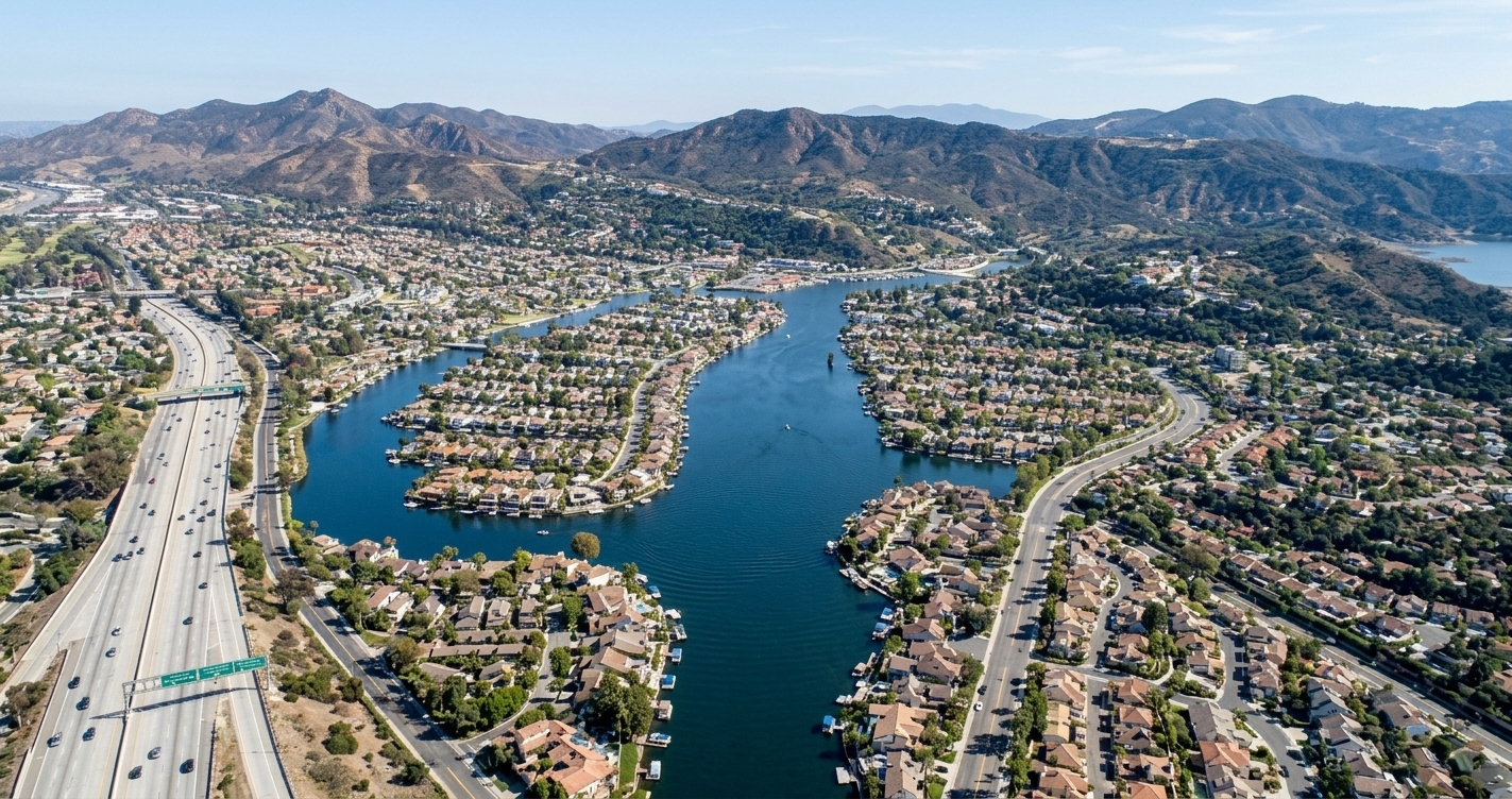
The aerial view behind this page captures the heart of Westlake Village, where Westlake Lake and the surrounding Santa Monica Mountains frame a community split by the Los Angeles‑Ventura county line. South of US‑101, the 91361 ZIP code embraces the lake basin and core neighborhoods, while the area north of the freeway falls under 91362, covering North Ranch and other residential districts. A small PO Box zone, 91359, also serves the city. This map‑ready overview clarifies how the dual‑county reality shapes municipal services, school districts, and local business networking, giving residents, home‑buyers, and entrepreneurs a clear picture of where each ZIP code resides within the town’s distinctive geography. By visualizing these boundaries, stakeholders can better understand the unique layout of Westlake Village’s neighborhoods and make informed decisions about where to live, work, or connect.
To grasp the geographic complexity of Westlake Village, California, it helps to start with its 1960s master‑planned origin—a 12,000‑acre ranch that was envisioned as a “city in the country.” When the community was formally incorporated on December 11, 1981, the sprawling parcel was sliced by the line dividing Los Angeles County and Ventura County, creating two distinct municipal entities.
Los Angeles County side: This eastern portion encompasses roughly 3,456 acres and became the incorporated City of Westlake Village, the 82nd municipality in the county.
Ventura County side: The western portion includes about 8,544 acres, most of which was later annexed to the City of Thousand Oaks.
The county split directly influences the postal landscape. Residents and businesses on both sides of the line share three primary ZIP codes: 91361, 91362, and 91359. The first two codes serve standard street addresses, while 91359 is largely reserved for PO Boxes. Because ZIP codes cross municipal boundaries, a single address can belong to either county while retaining the same postal identifier.
Understanding this layered geography is essential for anyone searching for a westlake village ca zip codes by neighborhood boundary map. The map reveals how neighborhoods such as the lake‑front core, the northern North Ranch area, and the southern Island district align with the underlying ZIP code zones and the county line.
In practice, the dual‑county reality affects school district assignments, property‑tax rates, and local service provision, making the postal boundaries a practical guide for navigating everyday life in Westlake Village.
91361 vs 91362: ZIP code map and boundary along the freeway
Metric
ZIP 91361
ZIP 91362
Geographic Position relative to US‑101 (ZIP code boundary)
Spans both sides of the US‑101 freeway, with core portions north/northeast and extending south toward the lake/Agoura Hills corridor.
Predominantly north of the US‑101 freeway, extending into eastern Thousand Oaks and the surrounding hills.
County Jurisdictions Covered
Dual‑county overlap: portions of Los Angeles County (city of Westlake Village) and Ventura County (unincorporated/Thousand Oaks areas).
Entirely within Ventura County, comprising eastern Thousand Oaks and North Ranch.
Landmark Neighborhoods
Westlake Island, First Neighborhood, Southshore, and areas surrounding Westlake Lake.
North Ranch, Lang Ranch, custom hillside estates, and suburban pockets of eastern Thousand Oaks.
Primary School Districts
Split between Las Virgenes Unified School District (LA County side) and Conejo Valley Unified School District (Ventura County side).
Served primarily by Conejo Valley Unified School District.
Postal Character
Assigned a “Westlake Village, CA” mailing address, serving as the primary postal routing footprint for lake‑adjacent and cross‑border neighborhoods.
Shares a “Westlake Village / Thousand Oaks” postal character, functioning as the eastern Thousand Oaks and North Ranch identifier.
Freeway as Postal Divider
The US‑101 freeway, known locally as the Ventura Freeway, runs horizontally across Westlake Village and serves as the primary east‑west corridor that separates the two main postal zones. South of the freeway, the 91361 designation predominates, while the area north of the freeway is largely covered by 91362. This split is reflected on most ZIP code maps, allowing residents to quickly identify which side of the road their address belongs to. The freeway therefore acts as a de‑facto ZIP code boundary for everyday routing and service delivery.
County Line Through Lake
The Los Angeles County and Ventura County line cuts across the community in a perpendicular direction, intersecting Westlake Lake and the adjacent golf course roughly midway between Lakeview Canyon Road and Lindero Canyon Road. On the Los Angeles County side, the land was incorporated as the City of Westlake Village in 1981, while the Ventura County portion remains part of the neighboring city of Thousand Oaks. This division influences governance, school districts, tax assessments, and utility jurisdictions, making the county line a critical reference for property owners.
Postal Addressing Conventions
The United States Postal Service treats both 91361 and 91362 as part of the Westlake Village mailing area, permitting the city name to be used regardless of the underlying county. Consequently, addresses on either side of the county line can list Westlake Village, CA, and still be delivered correctly. This convention simplifies the user experience for residents and businesses, especially when consulting a westlake village ca zip codes by neighborhood boundary map to understand which neighborhoods fall within each postal zone. It also supports local networking platforms that rely on accurate ZIP code boundaries to organize events and member directories.
ZIP 91361: Westlake Island & First Neighborhood Map
First Neighborhood Overview
Nestled just south of US‑101, Westlake Village enjoys a peaceful setting removed from highway bustle.
The community lies wholly within Los Angeles County, sharing the county’s rich cultural diversity and economic vitality.
A short drive north reaches the bustling commercial corridor, while southward streets wind through quiet, tree‑lined neighborhoods.
Proximity to Westlake Lake grants residents immediate access to waterfront recreation, scenic trails, and seasonal bird‑watching.
Commuters benefit from swift connections to regional freeways, yet the neighborhood retains a distinct suburban calm.
For those seeking precise postal information, a detailed guide shows the westlake village ca zip codes by neighborhood boundary map clearly.
Local schools, parks, and civic centers sit within easy walking distance, fostering strong community ties.
The lake’s shoreline features walking paths and modest cafés that serve both residents and visitors.
Elevated spots occasionally reveal panoramic views of surrounding hills, especially on clear evenings when city lights glitter.
Housing ranges from modest single‑family homes to upscale estates, reflecting the mixed‑income demographic typical of Los Angeles County.
Public transit includes a nearby bus stop and a commuter rail station a few miles away, ensuring mobility without a car.
Seasonal events, such as a lakeside farmer’s market and summer concerts, draw crowds and enhance neighborhood vibrancy.
Overall, the strategic location south of US‑101 combined with the natural amenity of Westlake Lake creates an appealing environment for families, retirees, and professionals.
Because of its blend of convenience, natural beauty, and community spirit, Westlake Village continues to attract new residents eager for a balanced lifestyle.
Boundary
Located within the master‑planned framework of Westlake Village, the neighborhood follows recorded tract lines and strict covenants, conditions, and restrictions (CC&Rs). These boundaries connect residential parcels to shared community corridors and are overseen by a local association that enforces the recorded limits.
Residential tracts are bounded by neighborhood common elements managed under association guidelines.
Proximity to major local routes provides convenient access toward Los Angeles and Ventura County borders.
Parcels link directly to community‑maintained access points and structural dividers.
Lifestyle
Residents benefit from an active, community‑oriented environment supported by a range of shared amenities. The First Neighborhood Community Center at 31830 Village Center Rd, Westlake Village, CA 91361 (Phone: 818‑889‑0632) acts as a hub for events, classes, and resident resources.
Extensive greenbelt systems offer walking paths, open green spaces, and scenic outdoor recreation.
Exclusive use and rental options at the community center are available to local households.
Homeowner association dues—collected quarterly—fund ongoing maintenance of common areas, landscape preservation, and operational reserves.
Regularly scheduled association operations keep shared spaces tidy and functional.
Architecture
The architectural character of Westlake Village reflects a cohesive master‑planned design, blending traditional suburban comfort with distinct California styling. Exterior aesthetics and any modifications are carefully reviewed to preserve property values and neighborhood harmony.
Uniform guidelines enforced by the association’s review committees maintain visual continuity.
Single‑family and multi‑family homes feature coordinated color palettes, established landscaping standards, and integrated outdoor living spaces.
Well‑maintained structural common elements are sustained by reserve funds and regular dues allocations.
For a visual reference, consult the westlake village ca zip codes by neighborhood boundary map to see how these defined parcels align with local amenities and infrastructure.
Westlake Island: A Guard‑Gated Community in ZIP 91361
Westlake Island rests like a polished jewel in the middle of Westlake Lake, a tranquil body of water that borders the upscale community of Westlake Village. The island is tethered to the mainland by two elegant bridges, each offering a scenic route that greets residents and visitors alike with sweeping water vistas and mature oak groves. One bridge arches from the southeast shore, linking directly to the gated entrance of the community, while the counterpart spans the western rim, providing an alternate passage for service vehicles and emergency crews. Because the island is completely private, only authorized owners, guests, and staff may set foot on its paved walkways, and every entrance point is monitored around the clock by a state‑of‑the‑art security system that includes 24‑hour patrols, video surveillance, and controlled access gates. Inside, the enclave showcases a curated collection of luxury homes, each positioned to enjoy unobstructed lake views, private docks, and direct shoreline access. The surrounding shoreline of Westlake Village is divided into distinct neighborhoods, each identified on the westlake village ca zip codes by neighborhood boundary map, helping residents understand the precise limits of their community. Together, the island’s isolation, meticulously maintained infrastructure, and unwavering commitment to safety create a singular living experience that feels both exclusive and intimately connected to the natural beauty of the lake and its surrounding hills. Residents also enjoy a private clubhouse on the island’s highest point, where sunset gatherings feature fire pits and panoramic lake views, reinforcing community spirit and quiet serenity.
Boundary Descriptions
Positioned at the heart of Westlake Lake, the island straddles the municipal line separating Los Angeles and Ventura counties. When reviewing the westlake village ca zip codes by neighborhood boundary map, buyers notice the distinct jurisdictional split that influences tax and school district assignments. The split influences emergency response protocols, with each county providing its own services.
Directly across the Los Angeles‑Ventura county line, creating dual‑county ownership.
Accessed through a single, designated bridge on La Venta Street that sits precisely on the boundary.
Portions of the island fall under separate municipal and school district jurisdictions, affecting services and voting precincts.
Lifestyle Features
Residents benefit from a secure, gated environment that operates around the clock, staffed by trained personnel at the entrance gate.
24/7 guard‑gated security ensures peace of mind for families and guests.
Waterfront activities include boating, electric vessel cruising, and fishing on the calm waters of Westlake Lake.
Private community perks comprise nearby country clubs, yacht club membership opportunities, and lakeside dining venues.
Seasonal events organized by the association foster a close‑knit community atmosphere.
Architectural Character
The island’s housing stock blends mid‑century origins with contemporary customizations, offering diverse living spaces.
Custom and semi‑custom single‑family homes constructed mainly during the 1960s and 1970s.
Square‑footage ranges from approximately 1,500 sq ft to over 5,000 sq ft, accommodating varied lifestyle needs.
Nearly every property includes its own private boat dock, enabling seamless lake access.
Many owners have upgraded interiors while preserving original architectural details, creating a blend of historic charm and modern comfort.
A detailed neighborhood map helps prospective owners visualize the island’s layout relative to surrounding amenities and county lines.
Westlake Island Association Fees
Amount
Quarterly HOA Dues
$960
Annual HOA Dues
$2,400
Foxmoor & Foxmoor Hills in Westlake Village (ZIP 91361)
Foxmoor is nestled in a distinctive wedge of Westlake Village, defined by three natural and man‑made boundaries. To the north, Westlake Boulevard sweeps east‑west, offering easy access to nearby retail corridors. The eastern edge is formed by Potrero Road, a quiet collector that threads through the community’s leafy streets. Completing the triangle, Potrero Valley Creek traces a gentle curve along the southern perimeter, providing a natural watershed that enhances the area’s green ambience. Within this tri‑bordered pocket, Foxmoor enjoys the full benefits of the Westlake Village 91361 postal designation, a zip that is recognized for its high‑performing schools, well‑maintained parks, and a sense of suburban calm.
The location’s geometry not only creates a sense of enclosure but also positions residents close to a variety of amenities. A short drive along Westlake Boulevard leads to the bustling shopping district where boutique retailers and gourmet eateries line the streets. Meanwhile, Potrero Road grants quick routes to the regional freeway network, making commutes to surrounding business hubs straightforward. The creek’s riparian corridor invites walkers and cyclists to explore shaded trails that connect to larger open‑space preserves in the Santa Monica Mountains. For families, the community’s proximity to top‑rated schools and recreation centers reinforces the appeal of a Westlake Village lifestyle that balances convenience with tranquility.
For anyone mapping the area, the phrase westlake village ca zip codes by neighborhood boundary map provides a useful reference point, illustrating how Foxmoor fits into the broader cadastral layout of the region while retaining its intimate, neighborhood‑focused character.
Boundary Descriptions
Foxmoor sits on the Ventura County side of Westlake Village within Thousand Oaks. The tract occupies the flat wedge between Westlake Boulevard and Potrero Road, just west of Westlake Lake, and wraps around Westlake Elementary School. The eastern edge follows Highway 23, the southern border runs along Potrero Road, and Potrero Valley Creek defines the north. A neighborhood map shows the street grid and parcel layout, matching the westlake village ca zip codes by neighborhood boundary map used by planners.
Ventura County portion with Westlake Village addresses (91361).
Bounded by Westlake Boulevard, Potrero Road, and Potrero Valley Creek.
Lifestyle Features
The Foxmoor Property Owners Association maintains amenities that support an outdoor lifestyle. A clubhouse hosts gatherings, and a pool offers seasonal swimming. A mile‑long creekside greenbelt links open space to private yards, while walking trails wind among mature trees and English‑named streets.
Clubhouse provides event space.
Pool is open during summer.
Greenbelt creates a natural corridor.
Trails connect homes to the creek and school.
Architectural Character
Most homes were built in 1968‑1969, with a few infill houses added through 1996. The tract includes about 270 single‑family parcels across sixteen streets, representing roughly 370 units historically noted. Home sizes range from 1,880 to 2,570 sq ft, median about 2,460 sq ft; larger layouts up to 3,590 sq ft exist after additions. Lot sizes vary from 6,100 to 9,150 sq ft, median near 6,970 sq ft.
Construction years: primary 1968‑1969, some up to 1996.
Home‑size range: 1,880–2,570 sq ft, median ≈ 2,460 sq ft; lot‑size range 6,100–9,150 sq ft, median ≈ 6,970 sq ft.
Foxmoor Attribute
Value
Build Years
1968–1969 (plus later builds to 1996)
Number of Homes
~270–370 homes
Home Size Range
1,880 – 2,570 sq ft
Lot Size Range
6,100 – 9,150 sq ft
Southshore Community on Westlake Lake’s Eastern Shore
Southshore is a distinctive waterfront enclave nestled within the Los Angeles County portion of Westlake Village, offering residents a blend of tranquil lakefront living and convenient access to the surrounding amenities.
Positioned just steps from the shimmering surface of Westlake Lake, the community enjoys panoramic views that change with the seasons, from golden sunrise reflections to misty evening silhouettes.
The neighborhood’s tree‑lined streets and private piers create a resort‑like atmosphere, while the proximity to major thoroughfares such as the 101 freeway ensures an easy commute to nearby employment centers and cultural attractions.
Southshore falls under the 91361 postal area, linking it to an established ZIP code that is recognized for its high‑performing schools, well‑maintained parks, and vibrant local businesses.
Homeowners benefit from a homeowners’ association that maintains common areas, protects the shoreline, and organizes community events ranging from summer barbecues to seasonal art showcases.
For those exploring the area’s geographic boundaries, the comprehensive westlake village ca zip codes by neighborhood boundary map provides a clear illustration of how Southshore’s borders intersect with surrounding districts.
The enclave’s design emphasizes sustainability, incorporating native landscaping and water‑conserving practices that honor the lake’s ecosystem.
Whether you are drawn by the promise of serene water views, the appeal of a tight‑knit community, or the convenience of nearby shopping and dining, Southshore represents a unique slice of Westlake Village life that balances natural beauty with modern comfort.
Boundary Descriptions
The enclave rests on the east and northeast shores of Westlake Lake, framed by Lakeview Canyon Road to the south, Triunfo Canyon Road to the east, and the gated entry called The Landing. A detailed westlake village ca zip codes by neighborhood boundary map helps buyers visualize these limits.
East‑side shoreline offers direct lake sightlines for residents.
Triunfo Canyon Road defines the eastern edge and provides easy access to nearby shopping corridors.
Lakeview Canyon Road marks the southern perimeter, connecting to regional thoroughfares.
The Landing serves as the primary community gate, reinforcing privacy.
Lifestyle Features
Living here centers on the private lake promenade, where residents stroll along landscaped pathways and enjoy communal beaches.
Exclusive promenade access encourages walking, jogging, and sunset watching.
Community beaches grant sand‑filled recreation without the crowds of public shores.
Shared boat slips enable docking for personal watercraft and communal sailing.
Seasonal events often gather on the lakefront, fostering neighborly bonds.
Architectural Character
Home designs blend lake‑view aesthetics with functional layouts, reflecting development across several decades.
Approximately one hundred single‑family homes showcase varied architectural styles, from mid‑century modern to contemporary ranch.
An attached townhome segment comprises roughly 278 – 284 units, organized across four Los Angeles County tract maps.
Many residences feature patio‑style outdoor spaces that open onto lake vistas.
Rooflines and windows are oriented to capture lake reflections and natural light.
Attribute
Value
Home Count
≈100 single‑family homes in Southshore
Community Type
≈278‑284 attached townhomes/patio homes
Lake Access
Direct lake promenade and shared boat slips
Westlake Island’s unique county split
Westlake Island sits on a man‑made lake inside Westlake Village, and a straight line of the Los Angeles County‑Ventura County boundary cuts directly through the middle of the island. This rare geographic phenomenon means that neighbors living on the same private street can belong to different counties, with distinct municipal departments, school districts, and property‑tax assessors.
On the Los Angeles County side, streets such as Whitesail Circle fall under the incorporated City of Westlake Village, while the Ventura County side includes streets like Topsail Circle, which are governed by the City of Thousand Oaks. As a result, residents on opposite sides of the same driveway may file their property taxes with separate county assessor offices, receive services from different fire and police agencies, and send their children to different public schools.
The bridge that provides the sole access to the island—La Venta Drive—had to meet building codes for both counties when it was constructed in the late 1960s. Today, this dual jurisdiction continues to affect everything from building permits to utility billing, creating a patchwork of rules that owners must navigate.
Understanding this split is essential for anyone considering a home on the island or for businesses that target the community. A clear view of the boundaries can be found on a westlake village ca zip codes by neighborhood boundary map, which shows how ZIP 91361 overlays the island and highlights the county line’s path.
North Ranch (ZIP 91362) Neighborhood Map Overview
Geographic Boundaries
North Ranch lies within ZIP code 91362, perched north of the US‑101 freeway. The area borders Westlake Boulevard on the east and the open‑space reserve to the west, creating a natural transition into the Oak Park foothills of Thousand Oaks. A detailed neighborhood map shows these limits alongside the county line that separates Los Angeles and Ventura counties.
Estate‑Scale Housing
Homes in this zone range from late‑1970s estates to recent custom mansions, many clustered in the Country Club Estates and Signature Collection sub‑areas. Large‑lot parcels often exceed half an acre, offering privacy and views of the adjacent hills.
Recreation Anchor
The private North Ranch Country Club at 4761 Valley Spring Drive serves as a social hub, featuring a 27‑hole championship golf layout, illuminated tennis and pickleball courts, and three community pools.
Commercial Conveniences
Shopping needs are met by the North Ranch Mall on E. Thousand Oaks Boulevard, a 185,128‑square‑foot center anchored by Trader Joe’s, Ralphs Fresh Fare, Rite Aid, and Petco.
Access and Lifestyle
Scenic corridors such as Kanan Road, Lindero Canyon Road, and Westlake Boulevard provide winding routes that connect residents to nearby office parks and the Promenade at Westlake. The blend of upscale residences, premier amenities, and convenient retail makes 91362 a distinctive segment of Westlake Village.
For those seeking the most precise depiction, a westlake village ca zip codes by neighborhood boundary map can be consulted to compare 91362 with adjacent ZIPs.
School districts property taxes Los Angeles County & Ventura
Civic Service / Administrative Body
Los Angeles County Side (City of Westlake Village / Regional Agencies)
Ventura County Side (City of Thousand Oaks / Regional Agencies)
Local Municipal Government
City of Westlake Village – Address: 31200 Oak Crest Dr., Westlake Village, CA 91361 – Mayor: Susan McSweeney – City Manager: Rob de Geus. Details correspond with the city planning map for the incorporated area.
City of Thousand Oaks – Mayor: Mikey Taylor – Interim City Manager: Andrew P. Powers.
County Board of Supervisors & Tax Assessor
Board of Supervisors: District 3, Supervisor Lindsey P. Horvath. Los Angeles County Assessor Jeff Prang (HQ: 500 W. Temple St., Los Angeles, CA 90012) – oversees property taxes for the LA side.
Board of Supervisors: District 2, Supervisor Jeff Gorell. Ventura County Assessor Keith Taylor (HQ: 800 S. Victoria Ave., Ventura, CA 93009) – oversees property taxes for the Ventura side.
Public School District
Las Virgenes Unified School District (LVUSD) – Address: 4111 Las Virgenes Rd., Calabasas, CA 91302 – Superintendent: Dr. Daniel Stepenosky – Enrollment: 9,923 (2025‑26). This school district serves the LA‑County portion.
Conejo Valley Unified School District (CVUSD) – Address: 1400 East Janss Rd., Thousand Oaks, CA 91362 – Superintendent: Dr. Mark W. McLaughlin – Enrollment: 15,442 (2025‑26). These school districts follow the county line.
Law Enforcement
Los Angeles County Sheriff's Department – Malibu/Lost Hills Station – Address: 27050 Agoura Rd., Calabasas, CA 91301 – Phone: (818) 878‑1808.
Ventura County Sheriff's Office – East County Station (Thousand Oaks Police Dept.) – Address: 2101 E. Olsen Rd., Thousand Oaks, CA 91360.
Fire Protection
Los Angeles County Fire Department – Station 144 – Address: 31981 Foxfield Dr., Westlake Village, CA 91361 – Phone: (818) 889‑1626.
Ventura County Fire Department – Station 31 (Westlake) or Station 33 (Lake Sherwood area) – HQ Address: 2400 Conejo Spectrum St., Thousand Oaks, CA 91320.
Confirming Parcel Boundaries
Because Westlake Village straddles the Los Angeles and Ventura county line, the most reliable source for lot lines and easements is the county assessor’s office for the relevant side. A current city planning map will show the municipal boundary, while the county’s parcel viewer displays legal descriptions. Residents often start with the westlake village ca zip codes by neighborhood boundary map to locate their ZIP code before drilling into the exact parcel data.
Understanding Property Taxes
The baseline for property taxes in Westlake Village comes from California Proposition 13, which fixes a general levy of 1 % of assessed value and limits yearly assessment growth to 2 % unless ownership changes or new construction occurs. Local bonds and school districts add a modest surcharge, resulting in an effective rate that typically falls between 1.13 % and 1.17 % for most homeowners.
School Districts and Inter‑District Options
Students in the community are served by two primary public school districts:
Las Virgenes Unified School District (LVUSD) – covers the Los Angeles County portion.
Conejo Valley Unified School District (CVUSD) – serves the Ventura County side.
Families may apply for an inter‑district transfer when a desired school lies outside their assigned zone. The process requires a release from the home district, proof of space availability, and adherence to each district’s deadline.
Zoning, Permits, and City Hall
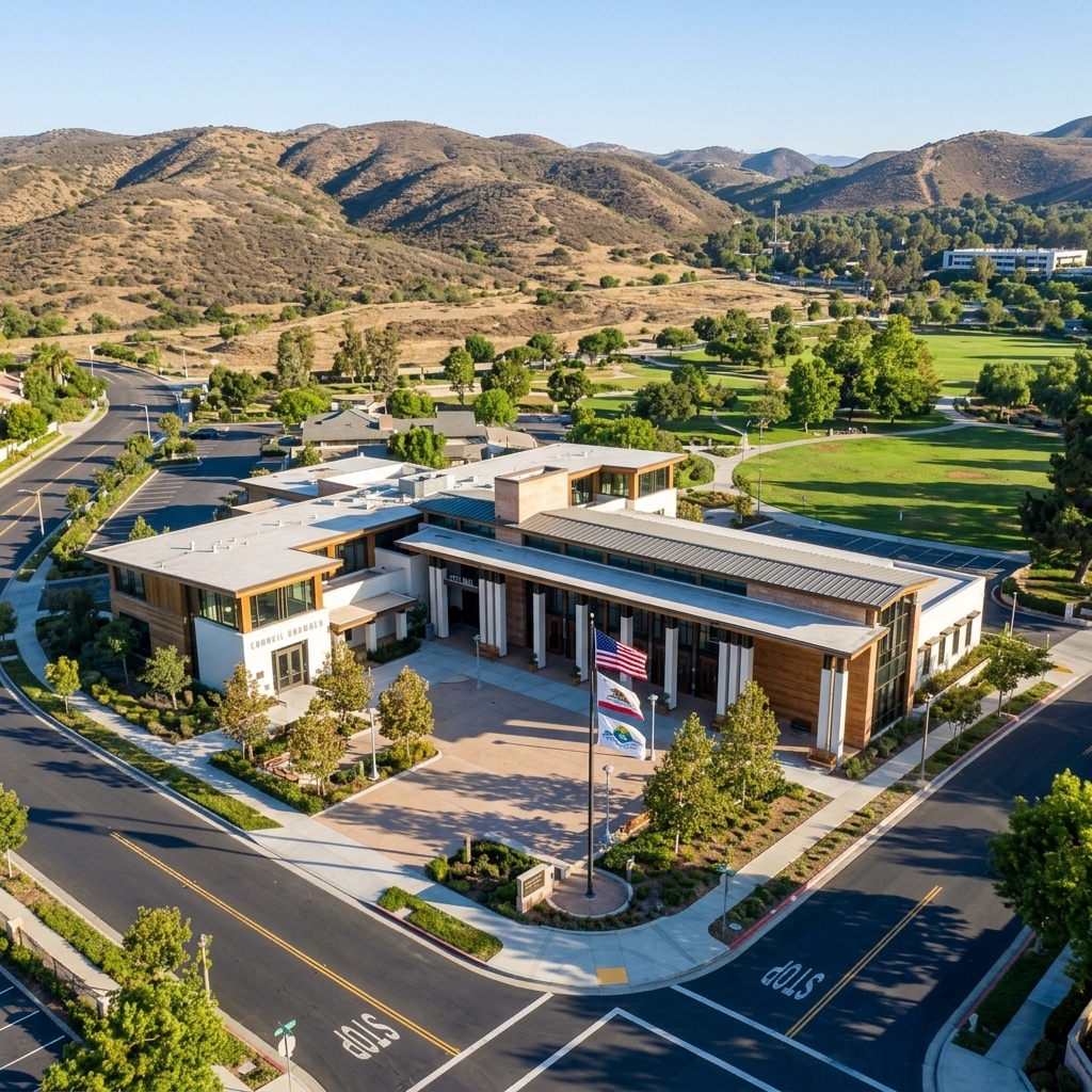
All new construction or major alterations must first obtain a clearance from the Planning Department, which is illustrated on the official zoning map. After zoning approval, a building permit is issued in coordination with Los Angeles County Building & Safety. Applications are submitted online with a $50 fee. Questions can be directed to Westlake Village City Hall at 31200 Oak Crest Drive, Westlake Village, CA 91361, where staff are available Monday through Friday, 8 AM – 5 PM.
Connecting with the Westlake Village CA Community
Geography and ZIP Code Layout
Westlake Village straddles a diagonal line that separates Los Angeles County from Ventura County, with the U.S. 101 freeway serving as a visible anchor. The community is served primarily by Westlake Village CA zip codes 91361 south of the freeway and 91362 north of it, while 91359 is reserved for PO Box routing. A detailed westlake village ca zip codes by neighborhood boundary map shows how neighborhoods such as First Neighborhood, The Island, and North Ranch sit within each postal zone.
Real Estate Considerations
When evaluating Westlake Village real estate, buyers must look beyond the ZIP code and examine the underlying county. Properties on the Los Angeles side belong to the Las Virgenes Unified School District, whereas Ventura‑side parcels fall under Conejo Valley Unified. Tax rates, assessor records, and special assessments differ between Los Angeles County and Ventura County, so checking the appropriate county assessor’s office is essential for accurate cost projections.
Key Commercial Corridors
Local commerce thrives along three main arteries:
Russell Ranch Road – home to The Shoppes at Westlake Village, anchored by Target and a mix of dining and wellness venues.
Agoura Road – features Westlake Plaza and Westlake Commons, offering grocery, pharmacy, and specialty retail.
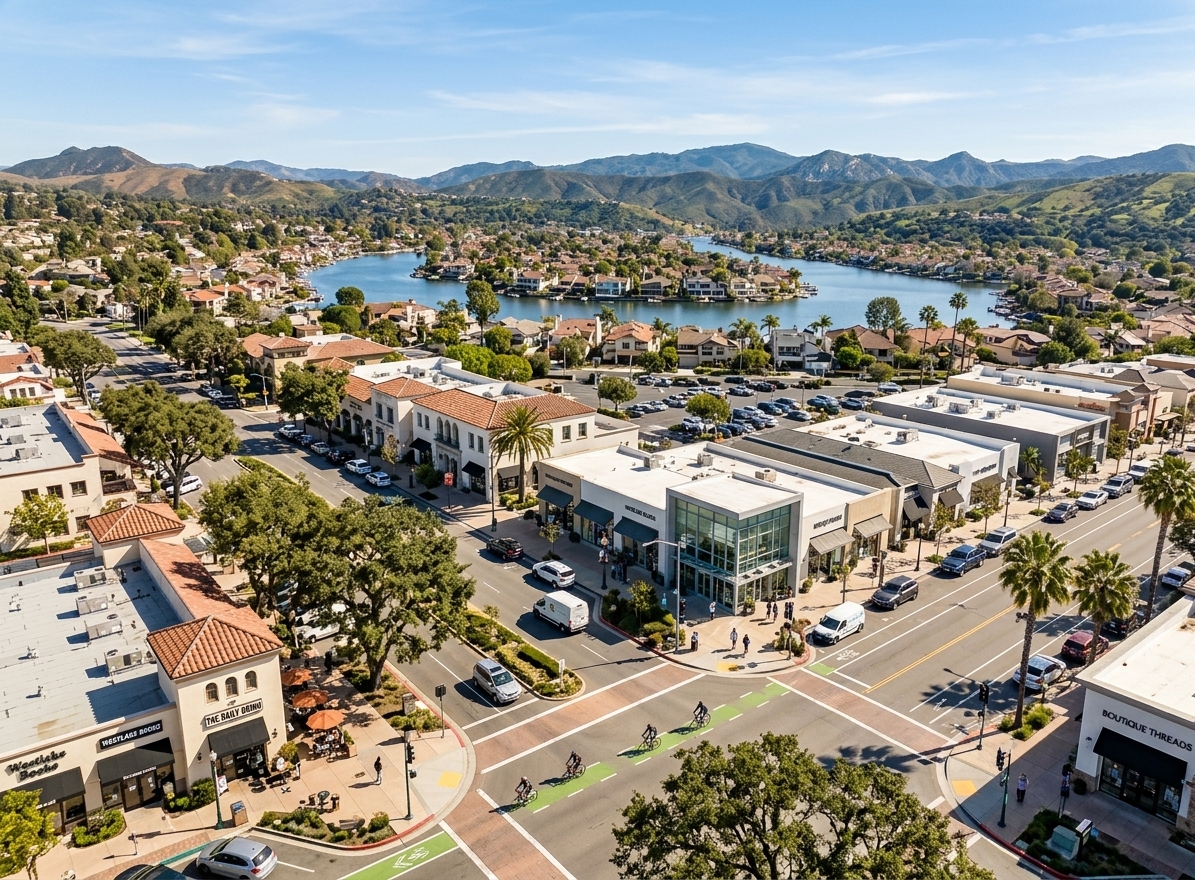
Thousand Oaks Boulevard – connects medical offices, financial services, and neighborhood eateries across the county line.
Commuting and Business Networking
The 101 freeway carries daily commuters east toward Los Angeles and west toward Ventura, while Lindero Canyon and Lakeview Canyon provide north‑south access. Because professionals serve clients on both sides of the county boundary, Westlake Village business networking becomes a strategic necessity. Collaborative events and shared chambers help local entrepreneurs capture the full regional market, turning a geographic split into a network advantage.
Lead Westlake Village in 91361 & 91362
Westlake Village sits on the historic Los Angeles‑Ventura county line, with the core of the lake and surrounding neighborhoods served by ZIP 91361 and the northern sections, including North Ranch, covered by ZIP 91362. This dual‑county geography creates a natural crossroads for residents, parents, small‑business owners, and anyone who wants to stay connected to neighborhood happenings.
For professionals who already generate referrals, the next step is to turn that influence into a structured platform. Westlake Village networking thrives when connectors, entrepreneurs, and neighborhood leaders claim an exclusive digital hub that links local merchants with families and homebuyers. By joining the TownSites Westlake Village community, you gain a branded website, searchable business directory, live local feed, and an AI‑driven content engine that keeps residents informed and engaged.
With a TownSites membership, each participating business pays a monthly networking fee, unlocking premium ads, event‑sponsorship opportunities, and monthly retainers for content, SEO, and press services. The model scales from a modest group of ten members to a bustling circle of fifty or more, allowing every stakeholder to benefit from predictable monthly income and amplified visibility across the 91361 and 91362 ZIP code areas.
Ready to become the catalyst for Westlake Village’s most vibrant business circle? Claim your exclusive TownSites local business circle today and start uniting merchants, professionals, and residents under one trusted digital roof.
Sep 17, 2026
Read More